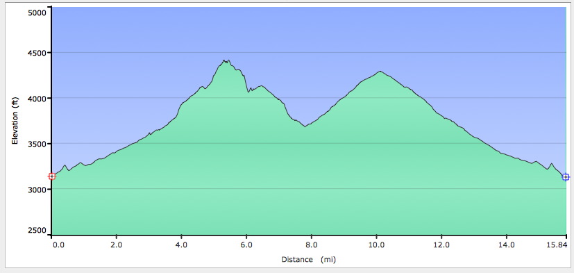
Elevation chart for route in preceding picture. Note insanely steep stuff around first peak (top of Trail 17). At least, I sure thought it was insanely steep. Especially when going up it. And even more so when coming down it. The second peak is the far east end of Trail 24; after that it’s pretty much all gradually descending back to the car on Trail 24.