Table of Contents > Dirt Biking > Older Dirt Bike Rides
Prev: 6N04 and 7N01
Next: 6N21 (City Highline Rd)
6N04 East (Leona Divide Trail)
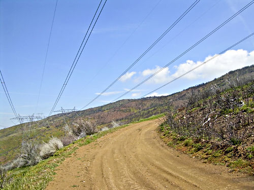
From San Francisquito Canyon Road, taking the 6N04 east instead of west. From a ride on 4/22/2011. We went all the way to Bouquet Canyon Road and crossed it, taking the power line utility road a little way up to get a view of the Mojave north. On the way back, we also detoured down the 6N09 to Spunky Canyon Road, to get it onto the GPS map.
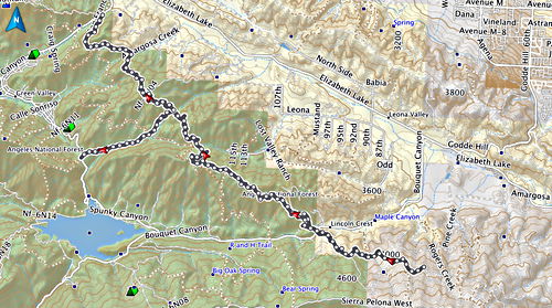
This road, between San Francisquito Canyon Rd and Bouquet Canyon Rd, is not at all difficult, though the day we were there it was rather dusty and slippery. The spur down to Spunky Canyon Road was rather rutted, especially towards the bottom where it was a bit daunting.


Looking south at the reservoir at the intersection of Spunky Canyon Road and Bouquet Canyon Road.
Apr 22 2011, 12:55:44


The rest of the photos in this set are taken from a height east of Bouquet Canyon Road.
Apr 22 2011, 13:24:23

The north end of Bouquet Canyon Road; the Tehachapis are in the distant background.
Apr 22 2011, 13:24:33


Clear evidence of a fire on this hill some years back. Possibly this was the Saugus Fire of 2007. But there have been a number of other recent fires in this area, including 1990, so it’s hard to know.
Apr 22 2011, 13:25:50

Prev: 6N04 and 7N01
Next: 6N21 (City Highline Rd)